Snowmobile Trails
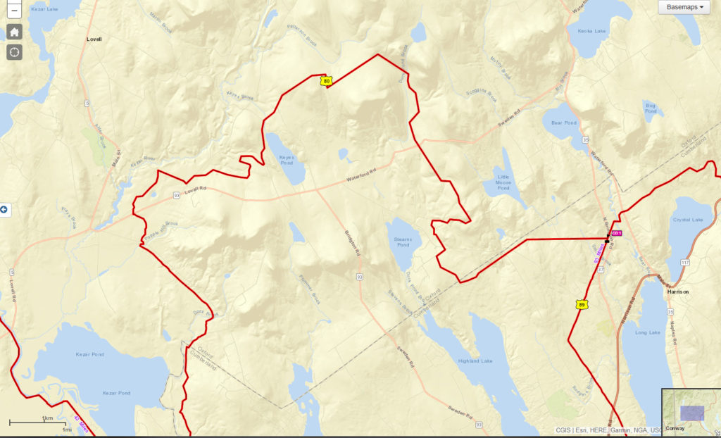
The Map of Maine’s Interconnected Trail System (ITS) is provided to snowmobilers through the joint effort of the Maine Snowmobile Association and the Snowmobile Division of the Maine Bureau of Parks and Lands, Department of Conservation under the direction of the MSA Trails Committee. The trails themselves are created through the efforts of the snowmobile clubs, the Snowmobile Division, local municipalities, supporting businesses and the many landowners throughout the state of Maine who generously allow access to sledders.
When viewing the ITS map: ITS trails are marked red, connector trails marked green. An additional 10,000 or so miles of trails crisscross and network heavily with this system all across the state. Local clubs and towns produce local and regional maps with details of individual trail systems.
ATV Trails
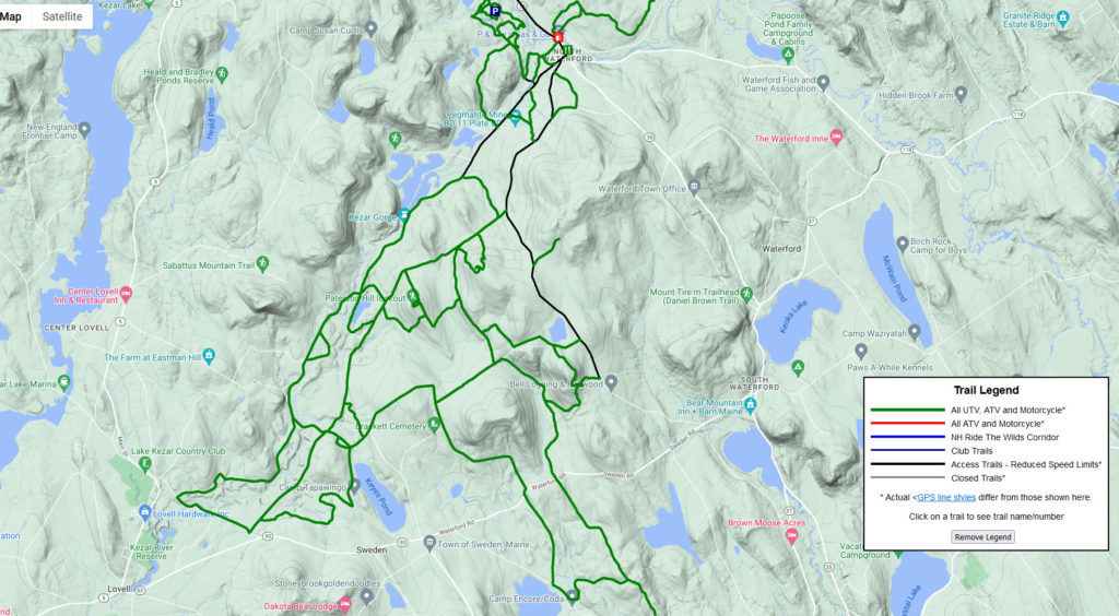
ATV trails cross parts of Sweden, and may be maintained by local ATV clubs. The closest local club would be in Waterford, The Pulpit Rock Trail Blazah’s. General ATV information can be found at ATV Maine.
- If ATV use is allowed on a road it will be marked with a shared use sign.
- If there are designated ATV trail systems, they will have the regular ATV trail signs on them. If roads or trails don’t have these signs then ATV use is prohibited.
Hiking Trails
There are no established hiking trails in Sweden, but Lovell, Waterford, Fryeburg, and Bridgton all have easy to moderate level hikes that may be accessible year round. Check out AllTrails for listings. Many of our roads in Sweden are rural and enjoyable to hike and explore, including old abandoned roads. Be sure not to trespass on private or posted property.
Cross Country/Snowshoe Trails
Winter is one of the best time to explore our local woods, although Sweden does not have a groomed trail system. ATV trails may be accessible for XC skiing or snowshoe excursions. Groomed trails can be found in Norway at the Robert’s Farm Preserve, at Highlands Ridge Trails in Bridgton, and on the golf course at the Lake Kezar Country Club.


